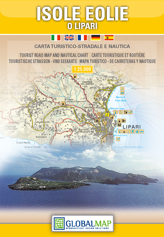
Aeolian (Lipari) Islands | Sicily | 1: 30,000 | GLOBAL MAP
£10.00
Stock Status: In Stock
Description
Description
Detailed road map of the the Aeolian Islands (Isole Eolie) also known as the Lipari Islands (Lipari, Vulcano, Salina, Stromboli, Filicudi, Alicudi, Panarea and Basiluzzo), the volcanic archipelago just north of Sicily, with an inset showing an overview of the archipelago at 1: 350,000. Roads are clearly marked and differentiated according to size, with road numbers and distances given for major roads, scenic routes highlighted and tracks and trails also marked. Hill shading is included and spot heights marked. Nautical information including lighthouses, bathymetry, navigational limits and underwater cables are also marked. The map also shows administrative boundaries, railways and ferry routes together with a variety of places of interest including tourist sites, campsites, sports venues and viewpoints.
On the reverse are insets showing the volcanic and seismic activities of the islands, together with street plans of Lipari and Canneto highlighting places of interest. There is also a list of hotels and campsites plus some general tourist information in Italian, English, French, German & Spanish.
| ISBN/EAN | 978 1 85879 6871 |
|---|---|
| Scale | 1: 30,000 |
| Format | Folded Map |
| Publisher | Global Map |
Reviews (0)
You must be logged in to post a review.
Reviews
There are no reviews yet.