

Daily Telegraph China & Mongolia | Wall Map | ROGER LASCELLES
£22.00
Description
Description
Political wall map of China and Mongolia including India, Pakistan, South East Asia and Japan. Countries are shown in bright colours with their borders enhanced by darker shading. Regional boundaries are also marked within some countries. The map shows the main road and rail networks, with towns and cities graded according to population. Major geographical features including mountain ranges, lakes and rivers are also marked and shipping routes shown. Latitude and longitude lines are drawn at 10° intervals.
The map includes insets showing the physical features of the area, including land elevations and the principal rivers, lakes, deserts and mountain ranges, together with an inset showing population. A further inset, at 1:16,000,000, covers the islands of Indonesia.
The durable encapsulated version is produced on quality 130 g/m² matt paper bonded between two sheets of tough, flexible, crystal clear plastic, perfect for framing without the need for glass and allowing you, should you wish, to write on/wipe off with dry or wet pens.
Legend: English, German, French, Italian
| Map Type | Encapsulated wall map ISBN/EAN: 978 1 85879 1449 |
|---|---|
| Scale | 1: 9,000,000 |
| Format | Wall map |
| Publisher | Roger Lascelles |
| Sheet size | 76cm x 120cm |
Reviews (0)
Related products
-
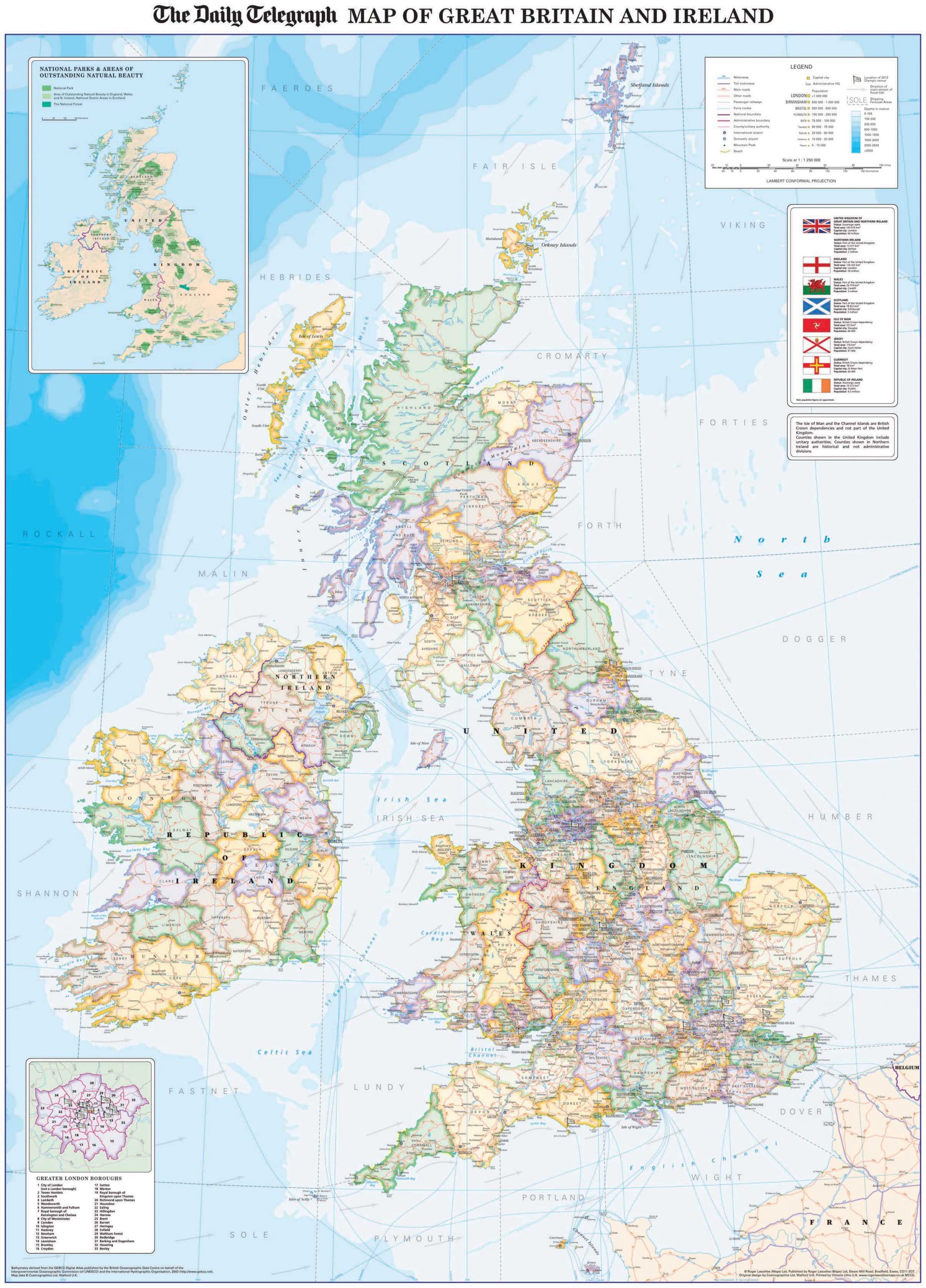
Daily Telegraph Great Britain & Ireland|Wall Map|ROGER LASCELLES
From £11.00 Select options -
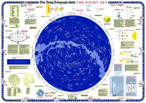
Daily Telegraph Night Sky | Wall Map | ROGER LASCELLES
From £11.00 Select options -
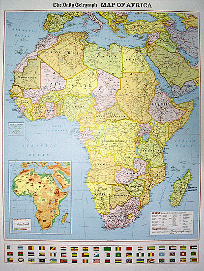
Daily Telegraph Africa | Wall Map | ROGER LASCELLES
From £11.00 Select options -
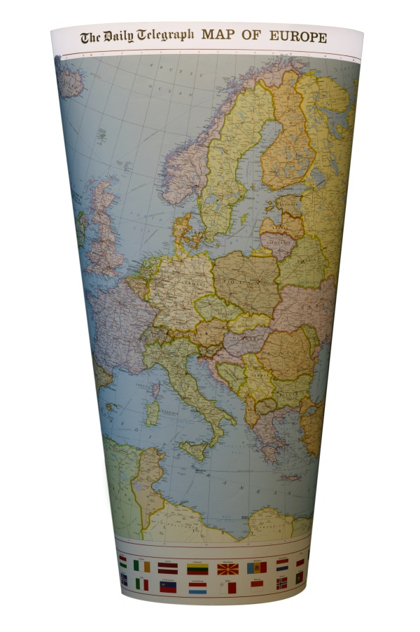
Daily Telegraph Europe | Wall Map | ROGER LASCELLES
From £11.00 Select options
Reviews
There are no reviews yet.